Grossglockner High Alpine Road: A High-Altitude Route into the Heart of the Alps
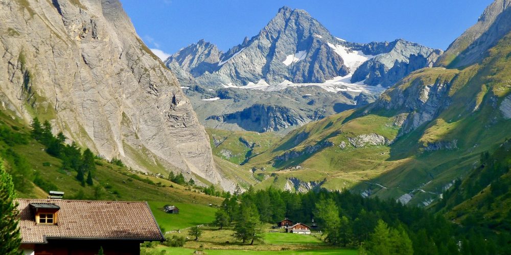
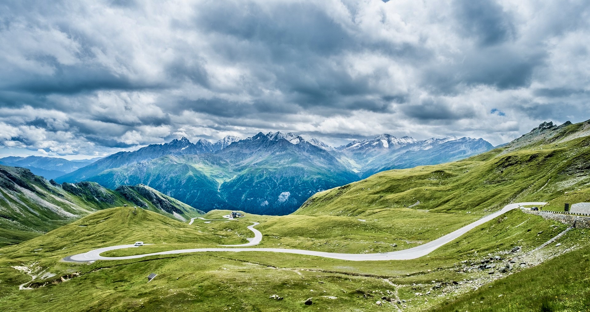
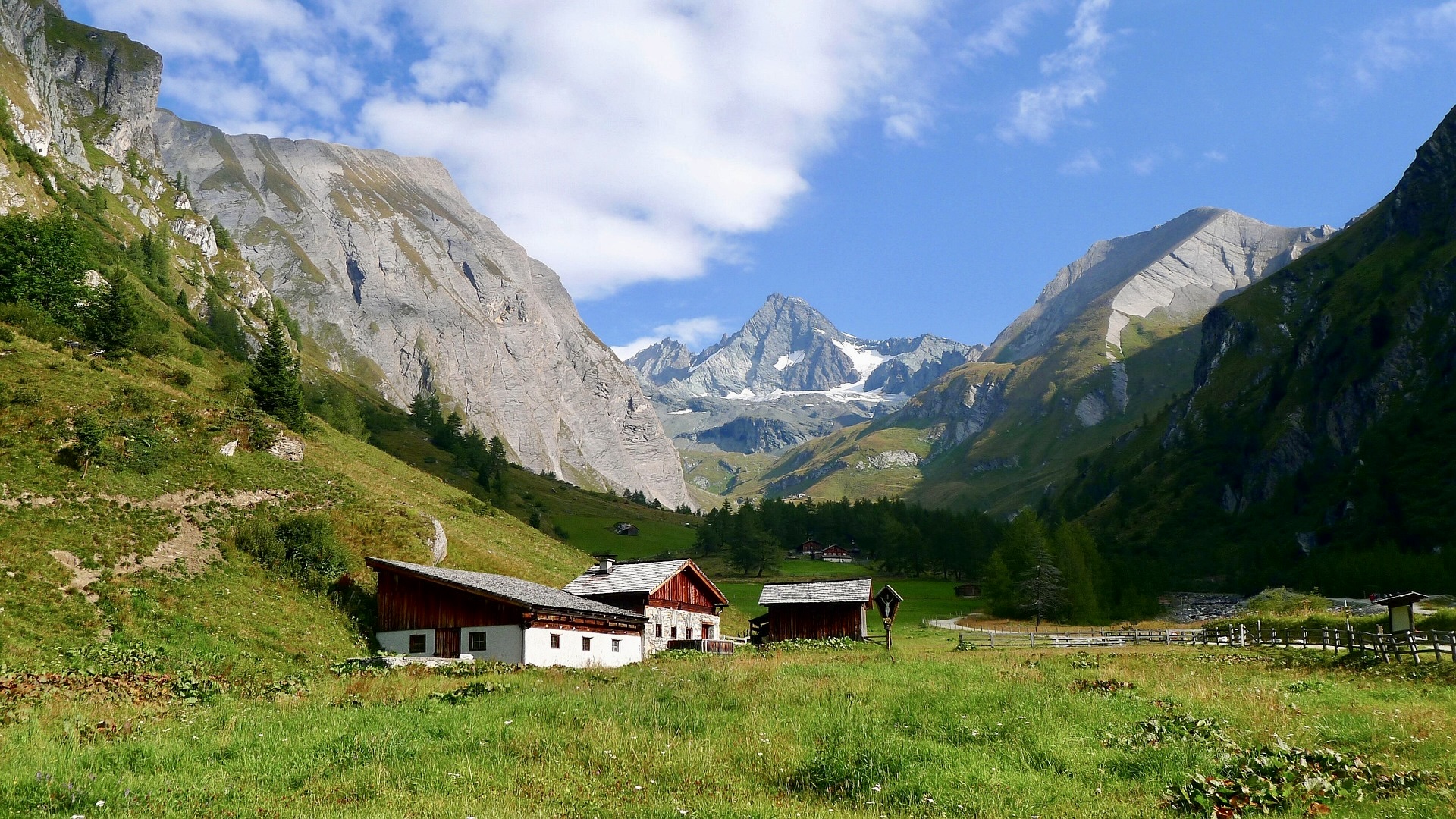
The Grossglockner High Alpine Road is one of the most famous panoramic roads in Europe. This high-altitude route leads across the Austrian Alps and offers access to the heart of the Hohe Tauern National Park. During a single trip, you’ll drive through mountain passes, see Austria’s highest mountain, the Grossglockner, and reach Austria’s largest glacier, the Pasterze.
(c) Grossglockner Hochalpenstrassen AG – Michael Stabentheiner
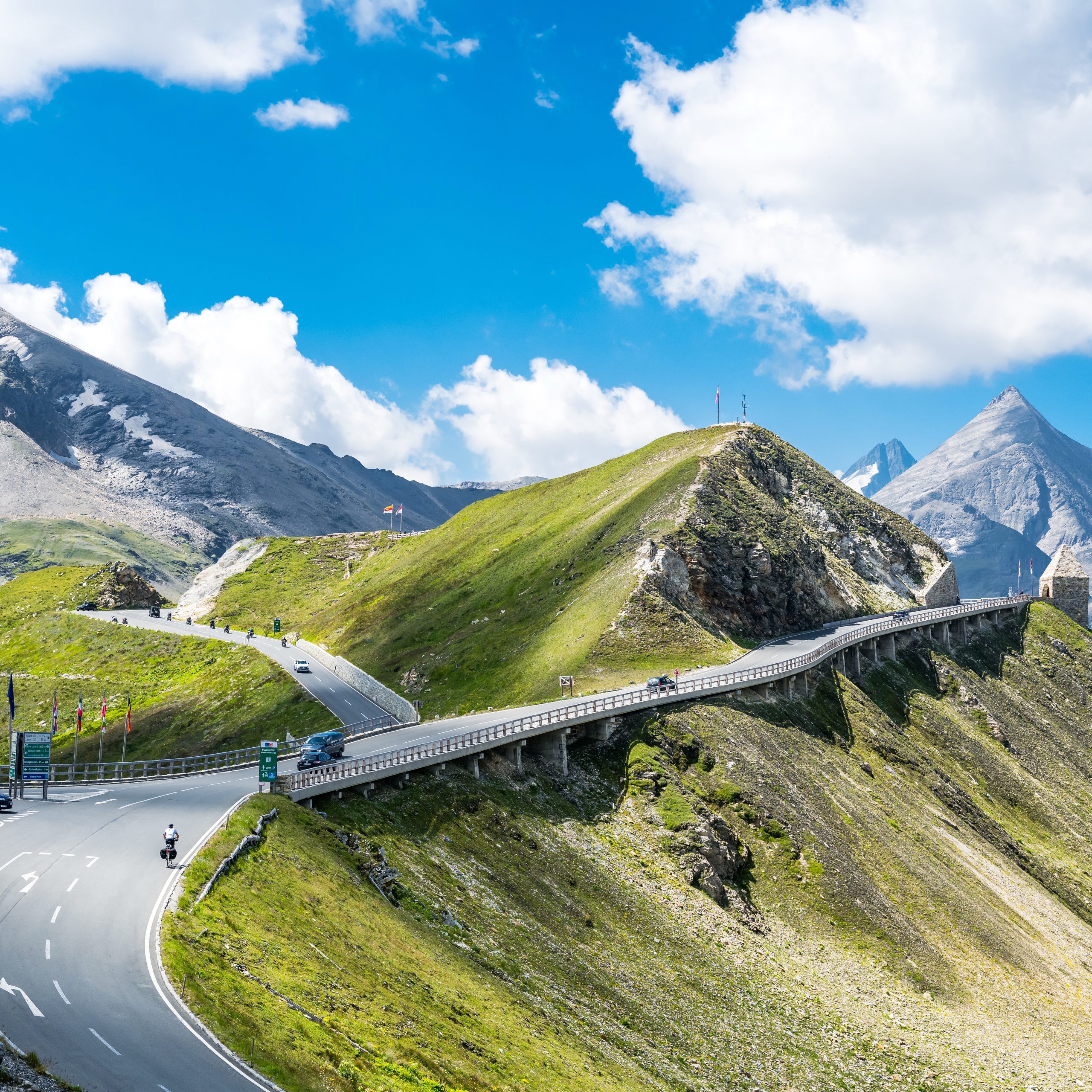
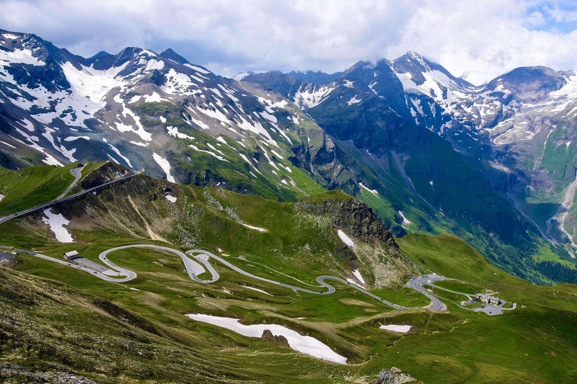
The road is approximately 48 kilometers long and consists of 36 hairpin bends. It was opened in 1935 and today is one of the most visited tourist attractions in Austria. Since 2015, it has also been under heritage protection. The route is designed to follow the mountain terrain and provide maximum views of the surrounding Alpine landscape.
Get inspired by our trip tip:
Accommodation
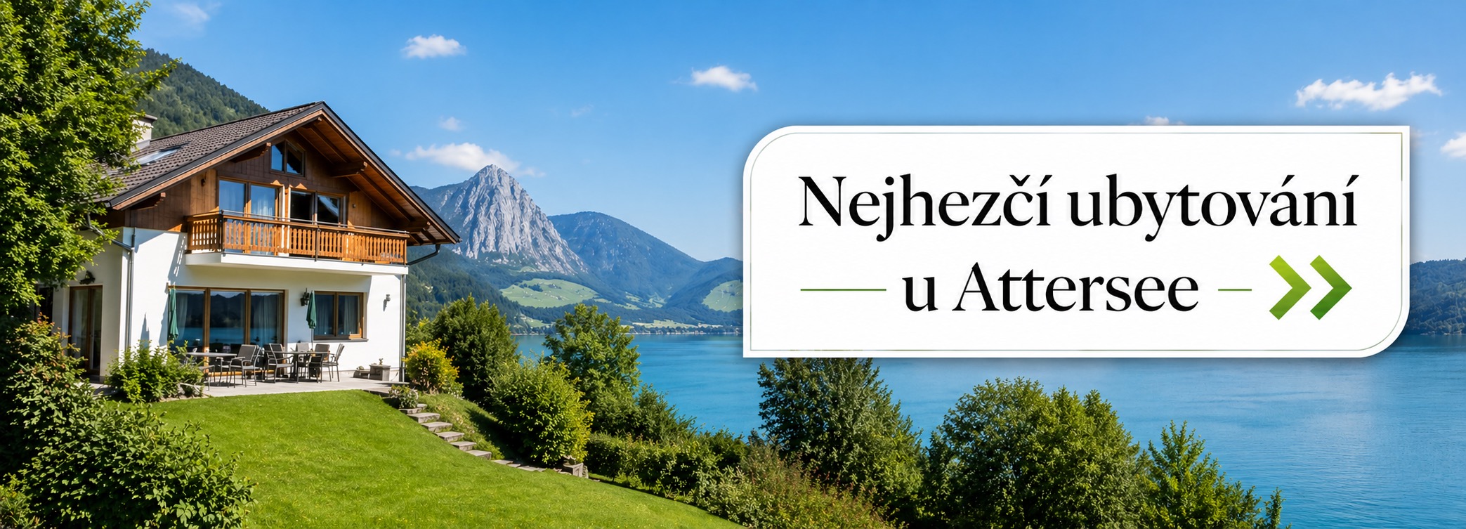
Personally, we choose Zell am See – Kaprun as the best base for this trip. You’ll find plenty of accommodation here, so there’s something for everyone. From simple apartments and family hotels to luxury wellness resorts. Plus, you’ll be right in a hiking paradise from where you can take other trips into the surroundings.
Emma Deluxe Aparthotel – affordable apartments
- Modern apartments with excellent ratings
Hotel Das Alpenhaus Kaprun – 4* hotel with breakfast and a pool at a good price
- Great hotel for couples with a nice wellness area
Tauern SPA Zell am See – Kaprun – luxury wellness resort
- We must highlight the high-quality gastronomy and the generous wellness center
- Part of the wellness center is for hotel guests only
Search for accommodation in Zell am See by map:
Basic Information about the Grossglockner High Alpine Road
The Grossglockner High Alpine Road connects the federal states of Salzburg and Carinthia. The road leads directly through the central part of the Hohe Tauern National Park and gradually climbs into a high-altitude environment. The route is accessible for cars, motorcycles, and bicycles. There are parking lots, viewpoints, and information stops along the entire length of the road.
Main route information:
-
road length: 48 km
-
number of turns: 36
-
highest point: Edelweiß-Spitze (2,571 m a.s.l.)
-
highest mountain nearby: Großglockner (3,798 m a.s.l.)
(c) Grossglockner Hochalpenstrassen AG – Michael Stabentheiner
Fees and Opening Hours of the Grossglockner High Alpine Road (2026)
Tolls for 2026
A special toll is paid to drive on the road (Note! This is not a highway vignette). The price is for daily access to the entire panoramic road.
Main prices 2026:
-
Car: €46.50 / day
-
Electric car: €40.00 / day
-
Motorcycle: €36.50 / day
-
Electric motorcycle: €32.50 / day
Other options:
-
Second day after the first visit: +€17.50
-
3-week card: €93 (for multiple visits within 3 weeks)
Important information:
-
A day ticket allows for an unlimited number of trips during one day.
-
If you enter after 6:00 PM, the price for a car is reduced to €36.50.
-
Payment is made at the toll gates in Ferleiten (north) or Heiligenblut (south).
Road Opening Hours
The road is seasonal, meaning it is closed in winter due to snow.
-
Open: approximately early May – early November
-
Closed: November – early May
For 2026, it is confirmed that the road is closed over winter until early May 2026.
You might also be interested in:
- 21 tips for the most beautiful lakes in Austria
- Holiday at Pressegger See in Carinthia
- Wörthersee: 11 tips for trips + accommodation
- Kitzsteinhorn Glacier: skiing and wellness holidays
The Most Beautiful Viewpoints and Stops on the Grossglockner High Alpine Road
It’s worth stopping several times during the drive. There are several viewpoints on the route that we rank among the most famous places in the Austrian Alps, and it would be a shame to miss them.
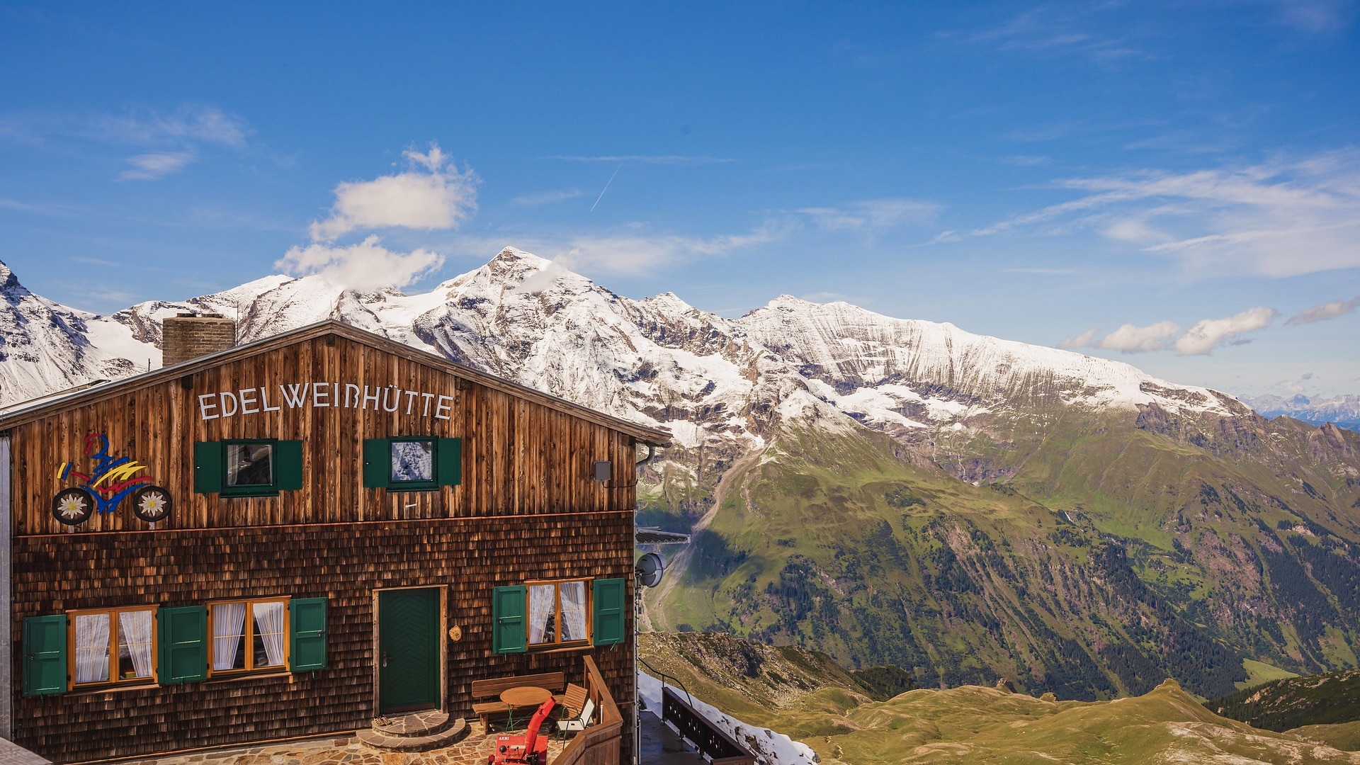
Edelweiß Spitze
Edelweiß Spitze is the highest point of the entire road. It lies at an altitude of 2,571 meters and is reached by a short detour from the main road.
From the viewpoint, it’s possible to see up to 30 Alpine peaks over 3,000 meters in good visibility. One of the main views is the north face of the Grossglockner massif. The spot is especially popular at sunrise and sunset when the surrounding peaks are best lit, which photographers in particular will appreciate.
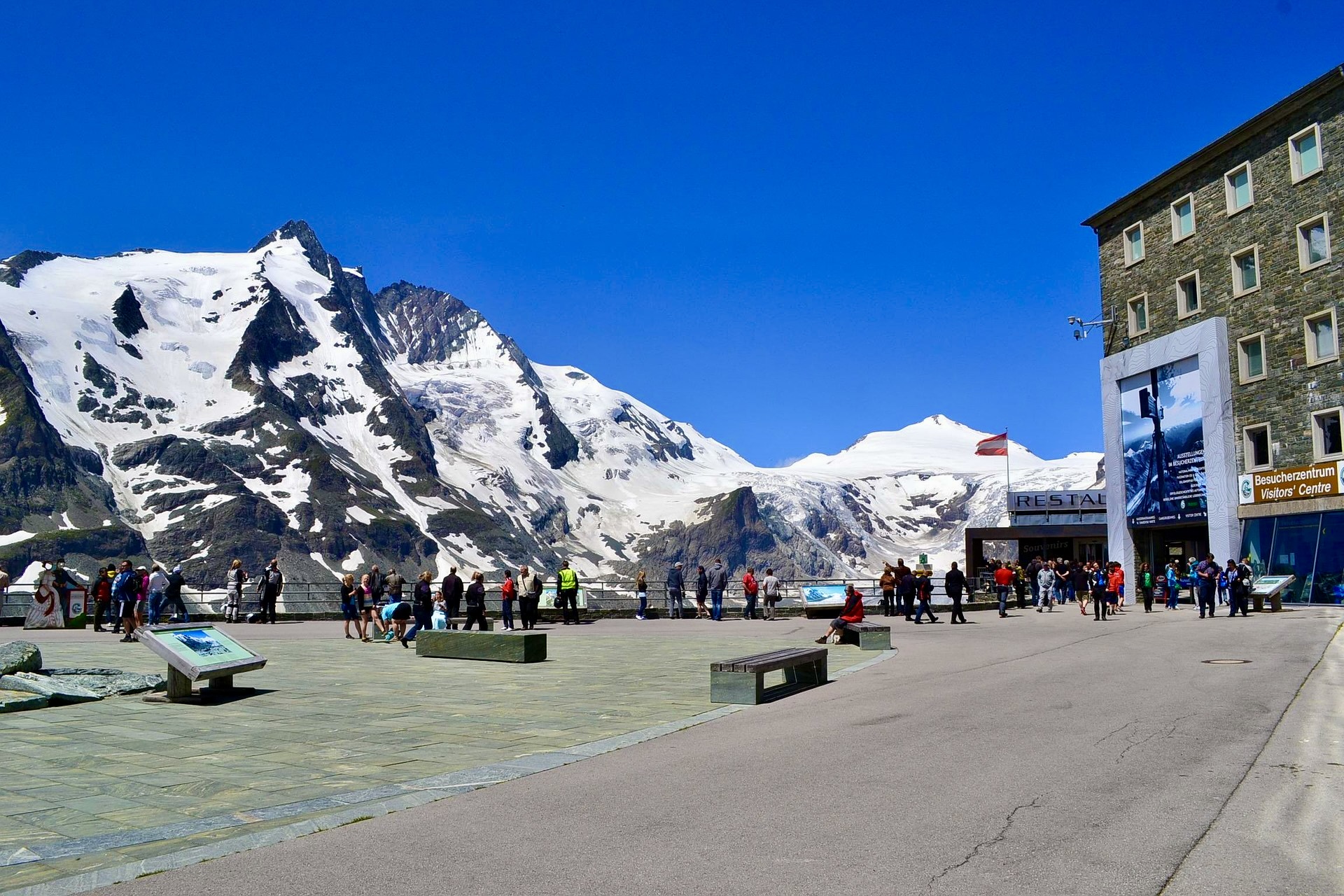
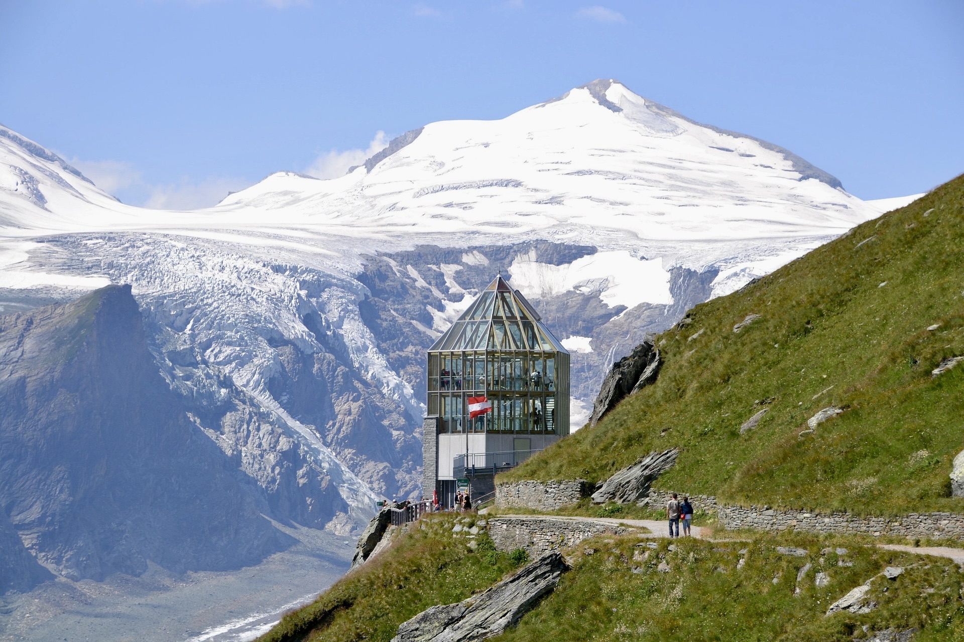
Kaiser Franz Josefs Höhe
Another main point of the route is the Kaiser-Franz-Josefs-Höhe viewpoint. For us, it’s one of the most visited places on the entire road. The viewpoint offers a direct view of the Grossglockner massif, the vast Pasterze glacier, and the snowfields in the surrounding mountains. The site includes a visitor center, restaurant, parking, and several exhibitions.
Visitor Center and Exhibitions on the Grossglockner High Alpine Road
As we’ve already mentioned, the main visitor center is located at the Kaiser Franz Josefs Höhe viewpoint. It offers several themed exhibitions focused on the nature and history of the area. We recommend visiting not only during rainy weather.
Among the most interesting are:
Gletscher Leben
- The exhibition explains the origin and development of glaciers and presents life in the extreme conditions of the high mountains.
Berg, die Frauen im Aufstieg
- An exhibition dedicated to women who have made their mark in mountaineering.
Car and Motorcycle Exhibition
- This is the highest exhibition of its kind in the world.
Hiking Trails along the Grossglockner High Alpine Road
The Grossglockner High Alpine Road is a scenic road, but it also serves as a starting point for many hiking trails and educational paths. We’ve selected the most interesting ones for you:
Piffkar Hike
One of the shorter but very attractive routes leads along the border of the Piffkar protected area. The route offers views of the Wiesbachhornwand rock face and is among the quieter areas with fewer tourists.
-
start: Edelweiß-Spitze parking lot
-
length: 4.7 km
-
elevation gain: 785 m
-
time: approximately 2 hours
Hochtor Educational Trail
A more demanding hike along the Hochtor educational trail. The path leads along the ridge past mountain lakes and moraines. Information boards explain the history of the region from Celtic and Roman times to the Middle Ages.
-
length: 8.1 km
-
time: approximately 5.5 hours
- destination: Brennkogel peak (3,018 m)
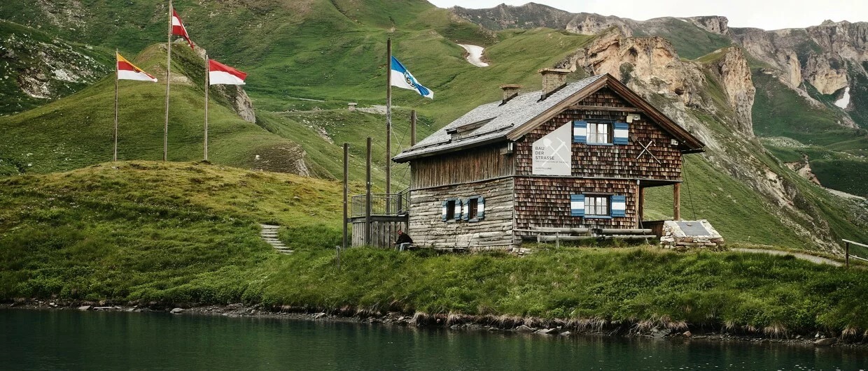
Fuscher Lacke Loop
An easier option for a shorter stop is the circular path around our favorite mountain lake, Fuscher Lacke. The path leads along rock faces and offers views into the Rauris Valley.
-
altitude: 2,262 m
-
short panoramic route
Glocknerwiesen Botanical Trail
On the south side of the Grossglockner is the Wunderwelt Glocknerwiesen botanical educational trail. It lies on the Pockhorner Wiesen meadows at an altitude of approximately 1,953 meters. Up to 140 species of Alpine plants grow in the area. Information boards will help you get to know the local flora and fauna.
Where to Eat on the Grossglockner High Alpine Road
There are mountain huts and restaurants all along the Grossglockner High Alpine Road. So it’s up to you where you feel like stopping. The offer of local restaurants and mountain huts mostly includes traditional Alpine cuisine, but you’ll also come across modern gastronomy.
Personally, we recommend the Schöneck inn, which is known for its regional specialties. Typical dishes we recommend trying include Kärntner Kasnudeln (Carinthian cheese noodles) and homemade bread made according to traditional recipes to accompany local Alpine meals.
Practical Tips for the Grossglockner High Alpine Road
-
Best time to visit: morning (fewer tourists and better visibility).
-
Summer operation: approximately 5:30 AM – 9:00 PM
-
Allow 3–6 hours to drive the road with stops.
-
The day ticket also includes entry to exhibitions and visitor centers along the road.
- Cycling is free, but the climb is physically demanding!
Where to Start for the Best Trip
What’s important to know is that the road has two main entrances.
Ferleiten (North Entrance)
Located near the town of Zell am See – most visitors start right here:
Advantages:
-
gradual climb into the mountains
-
best views throughout the journey
-
most iconic viewpoints are in the second half of the route
Heiligenblut (South Entrance)
A small mountain village below the Großglockner massif.
Advantages:
-
beautiful historic village
-
faster access to the Kaiser Franz Josefs Höhe viewpoint
Disadvantage:
-
you’ll miss out on the gradually opening panoramas of the northern part of the road.


